New crag near Shannon Falls (AMO wall)
New crag near Shannon Falls (AMO wall)
New Crag near Shannon Falls called AMO wall (Advanced Mountain Operations)
Last week Chris Lawrence, Brian Jones and I with generous funding and support of the Canadian Forces developed a cliff just north of Shannon Falls.
To get there walk as if your going to the falls but continue on the wide gravel trail north until you see orange flagging tape marking a trail on the right and a cliff through the trees. It’s about 5 minutes from the parking lot.
The climbs were developed for the military to provide an additional low grade instructional and practice cliff in Squamish. As well, the public will enjoy the venue for fun, safe and well bolted multi-pitch leads.
Climbers visited this cliff in the past because of the evidence of a few circa 1960`s-1970`s mystery bolts (the top tier) but no record has been found or recorded. The cliff commonly produces ice smears and is know in the West Coast Ice guide as the Olesen Slabs.
Seven pitches were developed in total and one 60 meter rope and 10 quick draws is all that is needed.
The following is a general route description:
Pitch 1: 5.7 28m 8 bolts (left)
Follow the line of bolts up towards the stump and up the glassy slab.
Pitch 1: var. 5.9 28m 7 bolts (right)
Crux move surmounting the slab.
Pitch 2: 5.6 22m 4 bolts (left)
Pitch 2: var. 5.10a 30m 8 bolts (right)
Cruxy down low with mono pockets on a steep slab.
Pitch 3: 5.8 25m 7 bolts (centre)
Crux up high pulling the bulge.
Pitch 3: 5.9 22m 8 bolts (left)
A technical and fun traversing dike feature.
Pitch 3: 5.7 30m (just) 10 bolts (right)
Tops out on the cliff for a view of Shannon Falls. Watch your ends on rappel or alternatively walk off 3-4minutes to the upper Shannon Falls view point.
By the way, the routes have names...
Pitch 1: 'The Relish Route' 5.7 28m 8 bolts (left)
Follow the line of bolts up towards the stump and up the glassy slab.
Pitch 1: var. 'Muckel onto ehrr' 5.9 28m 7 bolts (right)
Crux move surmounting the slab.
Pitch 2: 'The Relish Route' 5.6 22m 4 bolts (left)
Pitch 2: var. 'AWOL' 5.10a 30m 8 bolts (right)
Cruxy down low with mono pockets on a steep slab.
Pitch 3: 'The Relish Route' 5.8 25m 7 bolts (centre)
Crux up high pulling the bulge.
Pitch 3: 'Ghille suit' 5.9 22m 8 bolts (left)
A technical and fun traversing dike feature.
Pitch 3: 'The beaten zone' 5.7 30m (just) 10 bolts (right)
Tops out on the cliff for a view of Shannon Falls. Watch your ends on rappel or alternatively walk off 3-4minutes to the upper Shannon Falls view point.
Nice Job! Great teaching crag. My wife and I started on Muckel. I brought her up to the little ledge where the two 1st pitch routes split and she belayed me from there. (She's a little spooked about the cougar activity and didn't want to stand at the base.)
This also allowed us to string Muckle an AWOL together for a nice long pitch. We finished with The Beaten Zone. The topout is a nice spot to sit and have lunch and the walk off decent was easy to find. Thanks guys, a nice beginner friendly short multi-pitch crag.
This also allowed us to string Muckle an AWOL together for a nice long pitch. We finished with The Beaten Zone. The topout is a nice spot to sit and have lunch and the walk off decent was easy to find. Thanks guys, a nice beginner friendly short multi-pitch crag.
Climbed the same route as enchanted today.
Good little slab climbing area with some interesting features.
Just a note about access as we got a little lost. The gravel trail mentioned is the trail that takes you towards the chief area. So... take the paved trail around the information/tourist hut and follow it along. Take the first left which is a wide gravel trail in the direction of the chief. Look for orange flagging tape on your right. (we got onto the gravel trail that goes up beside the river at the base of Shannon Falls - not the correct trail)
damn
Damn, I wish I had read Marty's post yesterday, we went today looking for this place and took exactly the road Marty first took and got to the falls and couldn't find the climbs, then we found a trail in the woods (marked in pink and orange tape) and followed it for ~20 minutes and couldn't find anything, so we gave up. Now we know, next time...
Climbed "The Relish Route" in its entirety yesterday and took some photos.
The routes could use a topo, but I'll give some more info in the meantime, as the description is mysterious with its list of variations:
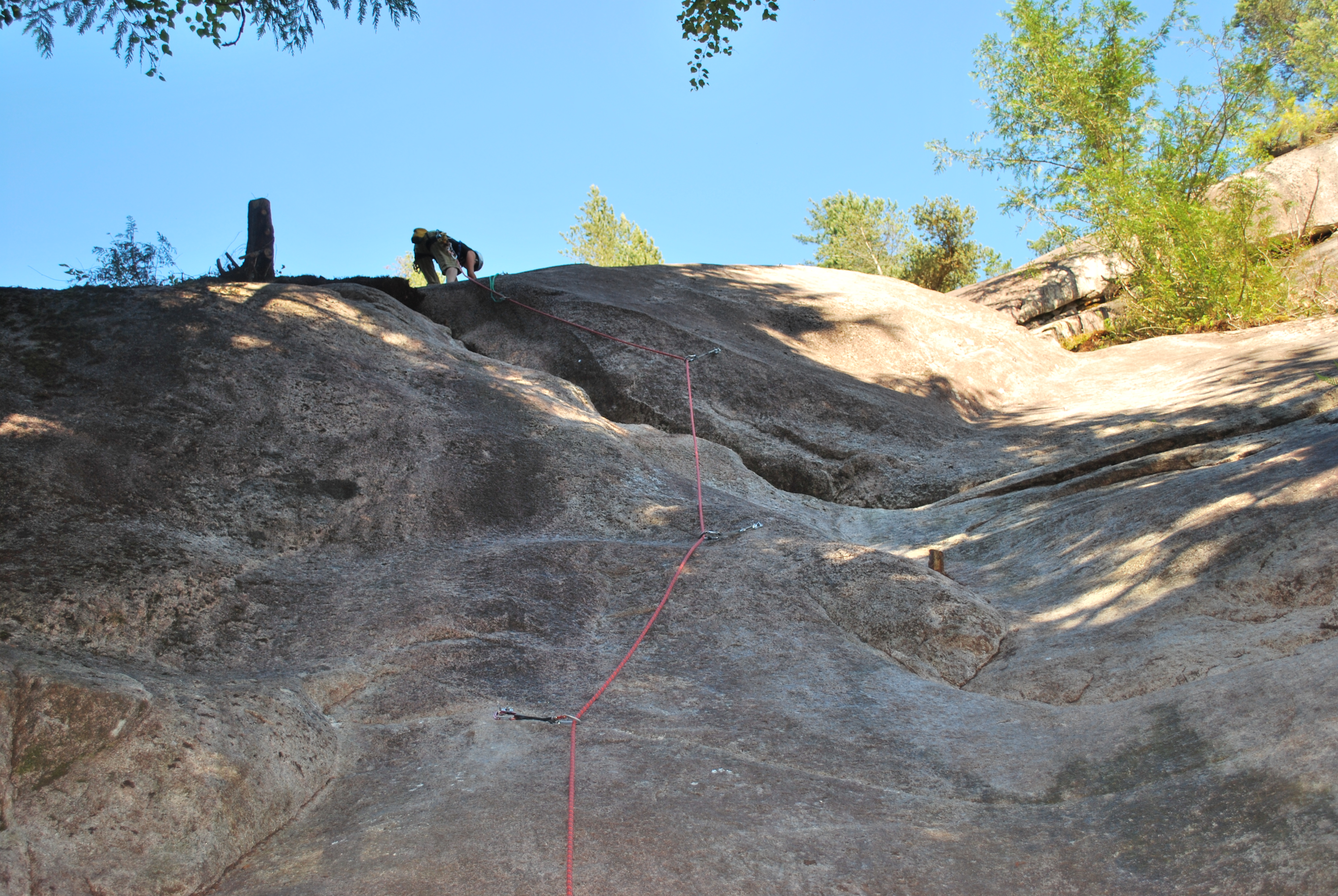
The variation as described in the first pitch seems to be the only true variation: 2 bolts out right over a cruxier section than to the left, which then rejoins The Relish Route (really deserving of its own name?)
From the first station, the variations (Relish Route and AWOL) lead in completely opposite directions, with the 3rd pitches (Relish Route and Beaten Zone) starting a good 10m from each other, and the final 3rd pitch (Ghille Suit) another 10 m away.
AWOL 5.10a out right leads directly to The Beaten Zone, skipping the ledge, and I would call these two pitches together a separate climb with a common start to The R. R. rather than a variation.
Looking up pitch one - the variation bolts can be seen out right:
If you're not planning on doing AWOL, the 10a second pitch, link the first 2 pitches, as the 2nd (5.6) pitch of The Relish Route is just 4 bolts, the final 3 of which are at about 5.4 climbing, to a huge ledge.
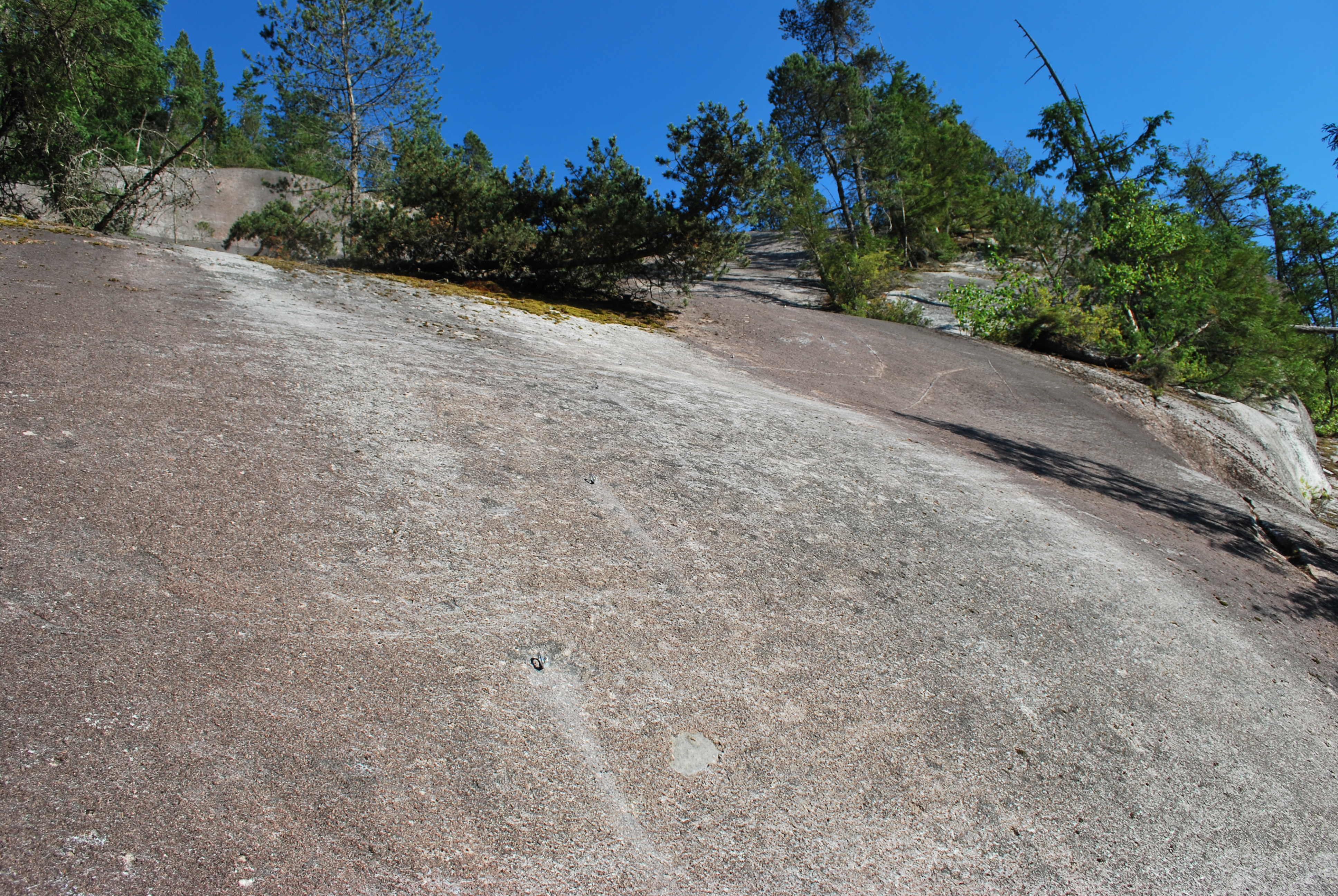
AWOL from the first station:
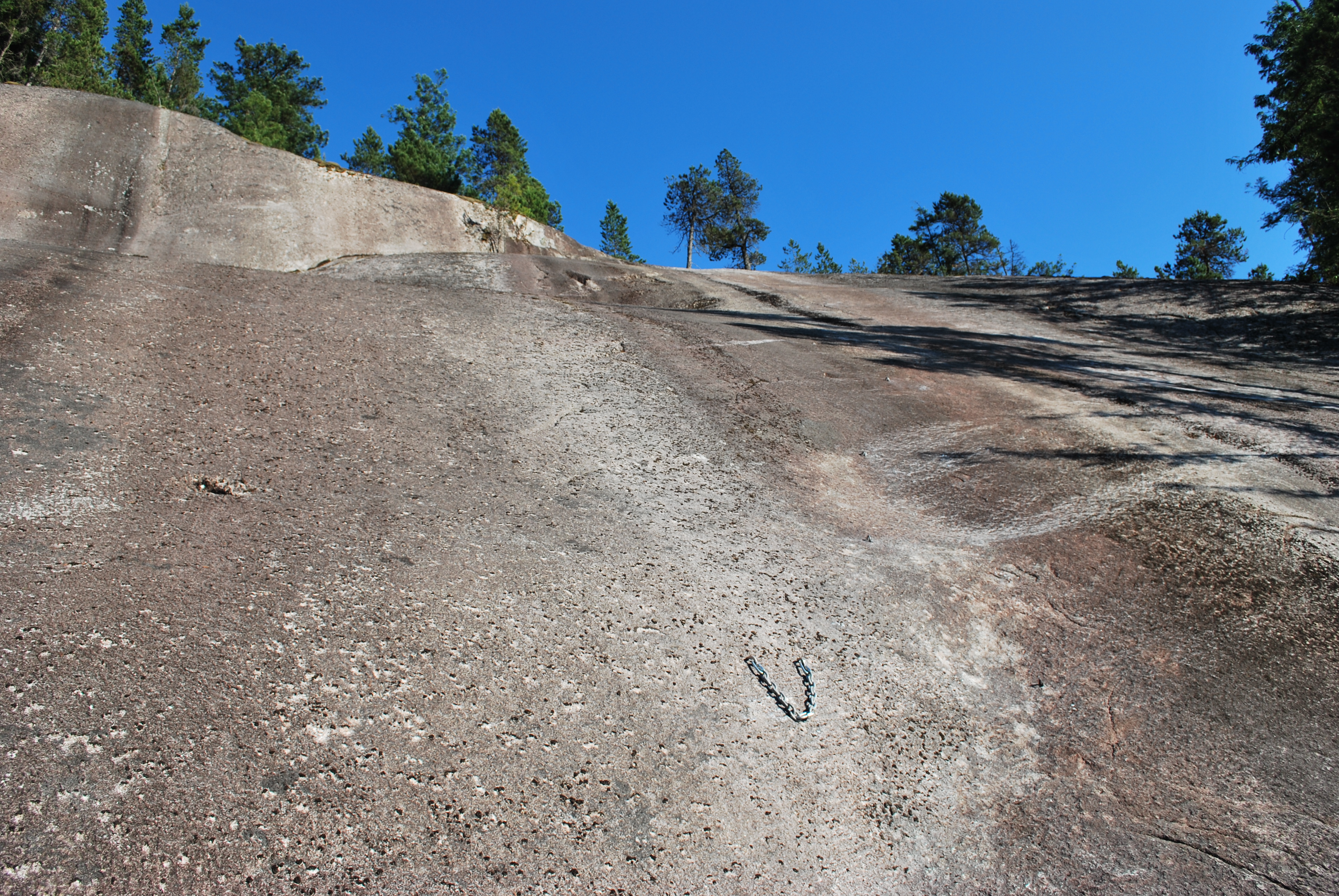
Looking up at The Beaten Zone:
Looking across the 3rd pitch ledge from the base of Ghille Suit - bolt lines visible for both G.S. and the R.R. (with Jenny at the base), and the anchors of AWOL/the B.Z. juuuuust visible past the end of the moss/dirt ledge.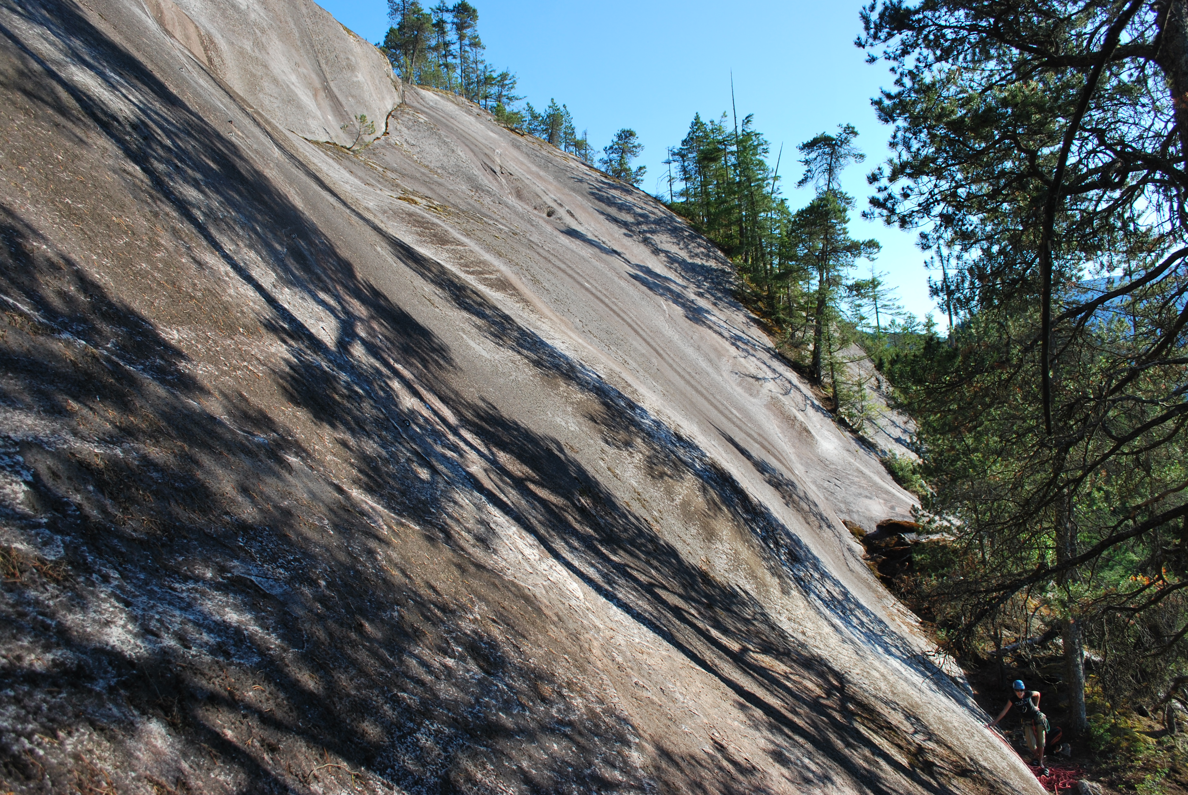
We rapped off the R. R. (the crux of which is the best climbing, by the way), and climbed the B.Z., but had no clue where the walk-off was (we tried), and so rapped to the base.
Here's a shot from the hillslope at the edge of the highway, at the Kiewit base, to show where the wall is: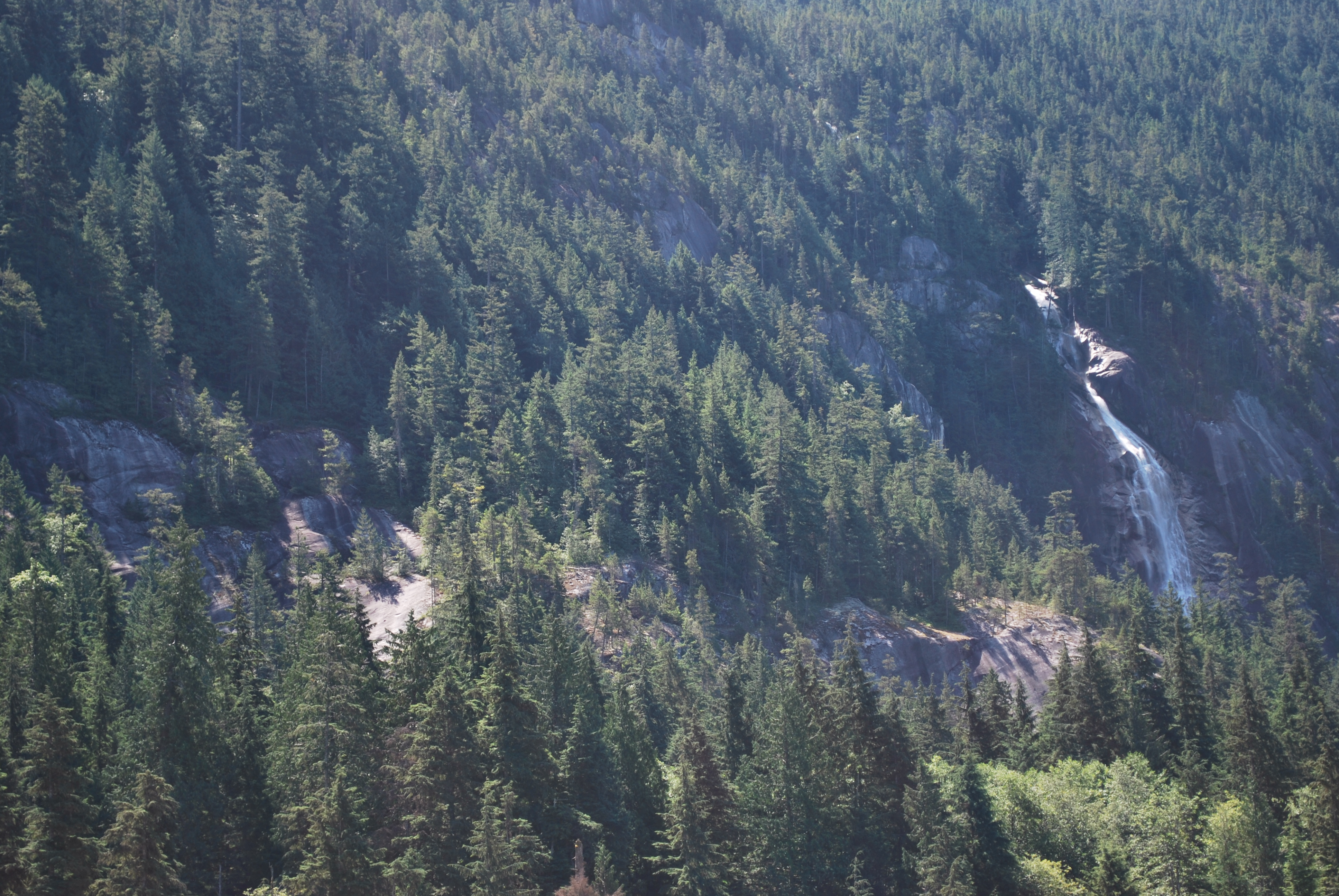
Right of center is a shaded wall - this is the top of the 3rd pitches. The only one to top out is the B.Z., which does so at the tree closest to the edge, between the shade and the sunny area.
Great atmosphere, decent climbing, nice easy rapping. It looks like we missed the best climbing - Ghille Suit and AWOL look like the nicest lines. We'll be back to try em out! Nice how you can easily climb all the pitches in one session with rapping if you wish.
A couple points to consider:
1. If the wall has been known as Olesen Slabs for ice, should it keep that name for rock?
2. As stated upthread, the combination of AWOL and the B.Z. seem to be a distinct climb rather than a variation, and Ghille Suit stands alone as well.
3. Glassy slab indeed! Harder than I was expecting, but not sure if that translates into sandbagged grades or me being a wuss. Felt like the latter, with the exception of the first 2 bolts - sticking to the line here seems hard.
Nice work boys! lots more slab in the area...
p.s. sorry about the ginormous photo size, still figuring this whole thing out
The routes could use a topo, but I'll give some more info in the meantime, as the description is mysterious with its list of variations:
The variation as described in the first pitch seems to be the only true variation: 2 bolts out right over a cruxier section than to the left, which then rejoins The Relish Route (really deserving of its own name?)
From the first station, the variations (Relish Route and AWOL) lead in completely opposite directions, with the 3rd pitches (Relish Route and Beaten Zone) starting a good 10m from each other, and the final 3rd pitch (Ghille Suit) another 10 m away.
AWOL 5.10a out right leads directly to The Beaten Zone, skipping the ledge, and I would call these two pitches together a separate climb with a common start to The R. R. rather than a variation.
Looking up pitch one - the variation bolts can be seen out right:

If you're not planning on doing AWOL, the 10a second pitch, link the first 2 pitches, as the 2nd (5.6) pitch of The Relish Route is just 4 bolts, the final 3 of which are at about 5.4 climbing, to a huge ledge.
AWOL from the first station:

Looking up at The Beaten Zone:

Looking across the 3rd pitch ledge from the base of Ghille Suit - bolt lines visible for both G.S. and the R.R. (with Jenny at the base), and the anchors of AWOL/the B.Z. juuuuust visible past the end of the moss/dirt ledge.

We rapped off the R. R. (the crux of which is the best climbing, by the way), and climbed the B.Z., but had no clue where the walk-off was (we tried), and so rapped to the base.
Here's a shot from the hillslope at the edge of the highway, at the Kiewit base, to show where the wall is:

Right of center is a shaded wall - this is the top of the 3rd pitches. The only one to top out is the B.Z., which does so at the tree closest to the edge, between the shade and the sunny area.
Great atmosphere, decent climbing, nice easy rapping. It looks like we missed the best climbing - Ghille Suit and AWOL look like the nicest lines. We'll be back to try em out! Nice how you can easily climb all the pitches in one session with rapping if you wish.
A couple points to consider:
1. If the wall has been known as Olesen Slabs for ice, should it keep that name for rock?
2. As stated upthread, the combination of AWOL and the B.Z. seem to be a distinct climb rather than a variation, and Ghille Suit stands alone as well.
3. Glassy slab indeed! Harder than I was expecting, but not sure if that translates into sandbagged grades or me being a wuss. Felt like the latter, with the exception of the first 2 bolts - sticking to the line here seems hard.
Nice work boys! lots more slab in the area...
p.s. sorry about the ginormous photo size, still figuring this whole thing out
And another bit about the access - from the Shannon Falls parking lot, you can skip the big loop back to the tourist area by picking up a trail right off the parking lot - at the east side of the lot (furthest from the highway), 8 parking spaces from the right - hard to see from the lot, but easy once you're in. This spits you out at the top of the hill at a grass field. Cross it, go left, you're on the gravel road. You'll see the slab through the trees on your right before you see the flagging tape, and think you've gone too far - the well-defined, flagged trail loops back towards the slab.
nice,
My Girl Friend and I just went and did the relish route, and I also climbed the 5.10 pitch. Over all nice spot that you have opened up. It was my GF's first multi and for teaching it is in my mind one of the best spots in the area. If i was to give any negitive feed back it would be that the frist pitch feels a little over bolted above the stump.
Thanks for all the hard work and im betting that there will be more lines put up in that area. I myself was looking at one or two today......
Thanks for all the hard work and im betting that there will be more lines put up in that area. I myself was looking at one or two today......
Be aware that this wall, especially the third pitches, can be very wet. On Sun Sep 13 the first pitch routes were dry, the second pitch AWOL traversed across a very wet section, and the third pitch routes were all soaked.
However, as luck would have it, we met Jeff Thomson who was cleaning and bolting a new line that begins to the extreme right of the second pitch ledge. This new third pitch -- I believe to be called 'Into the Mystic' -- has its own belay bolts, is about 35-40m. well bolted, and goes about 5.6/5.7. There are no rappel anchors at the top so exit by heading up the mossy slab directly into the forest until encountering a wall, then head right to descend an obvious climbers trail that leads down to the Shannon Falls view point trail.
It was very cool to climb a route that was bolted just minutes before!
Who is online
Users browsing this forum: No registered users and 2 guests


